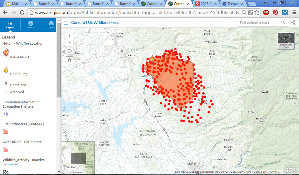
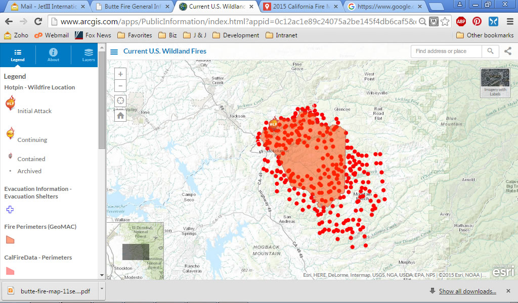
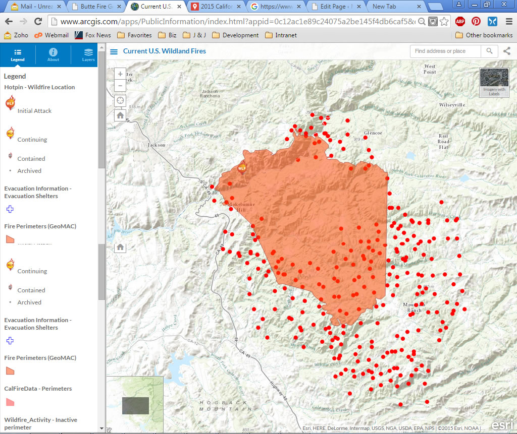
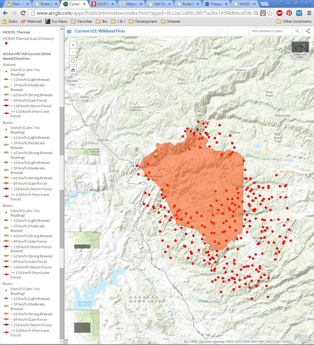
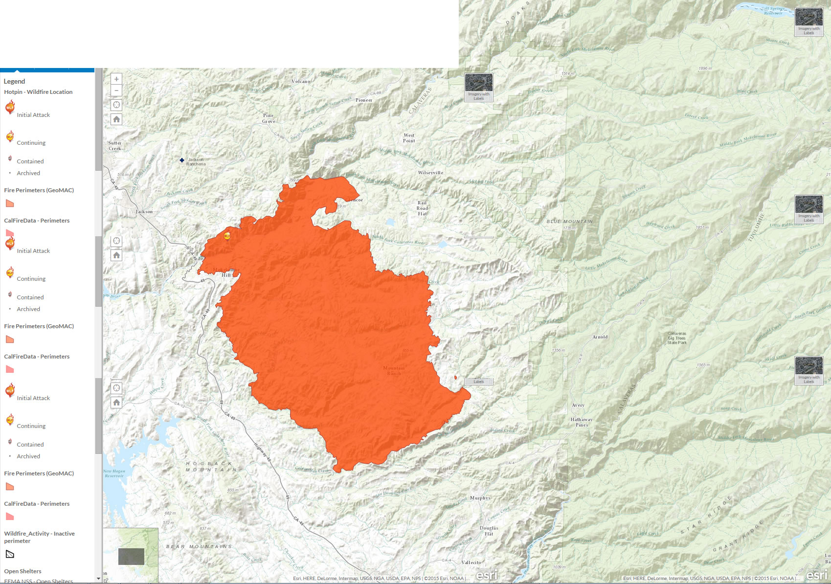
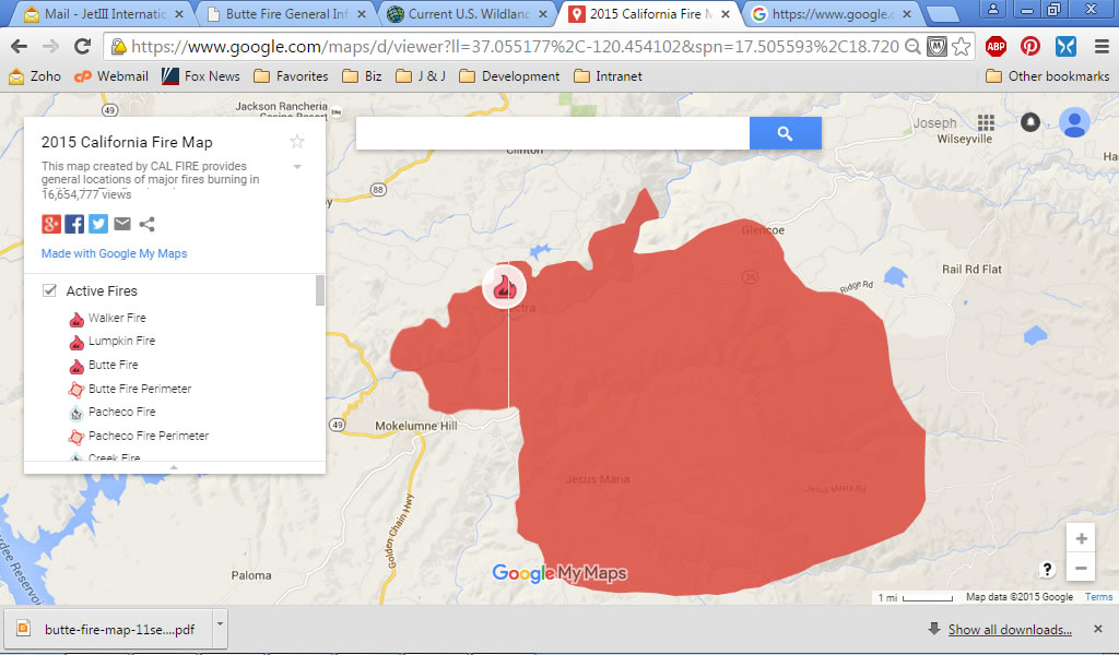
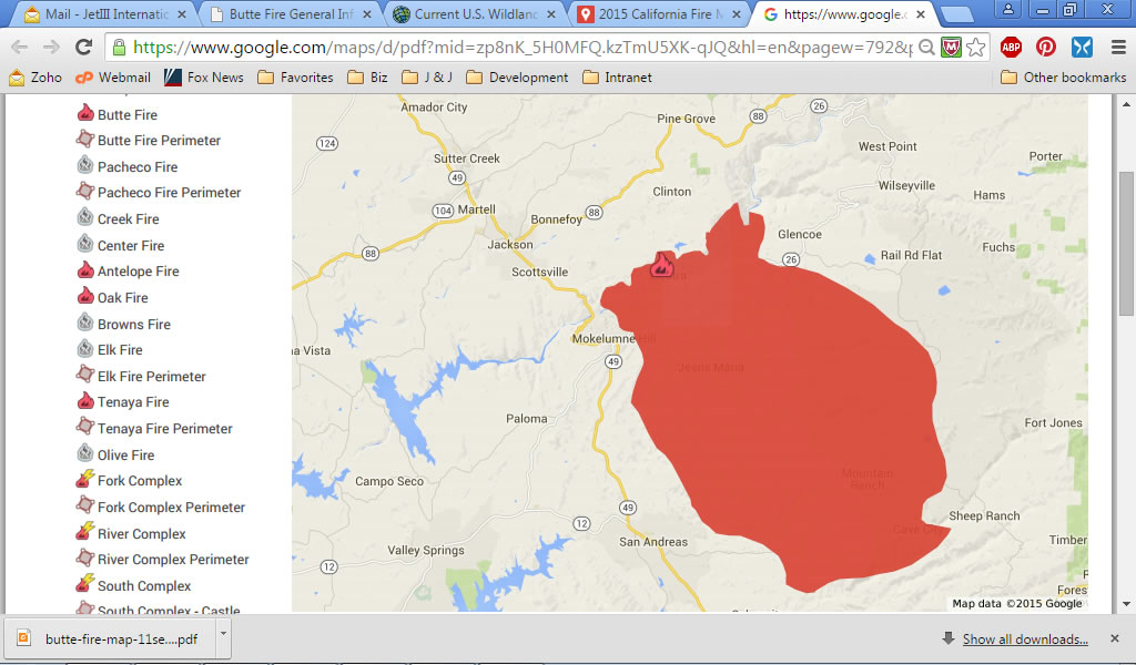
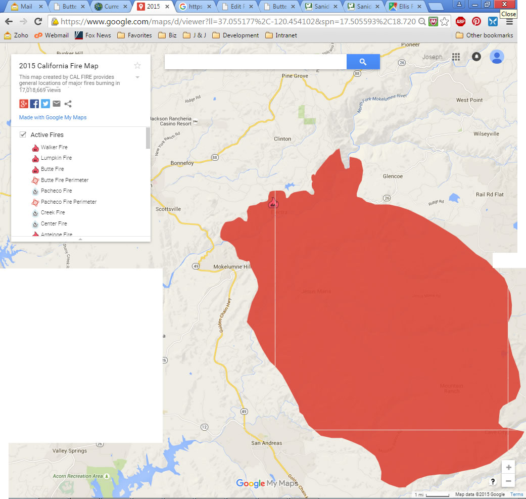
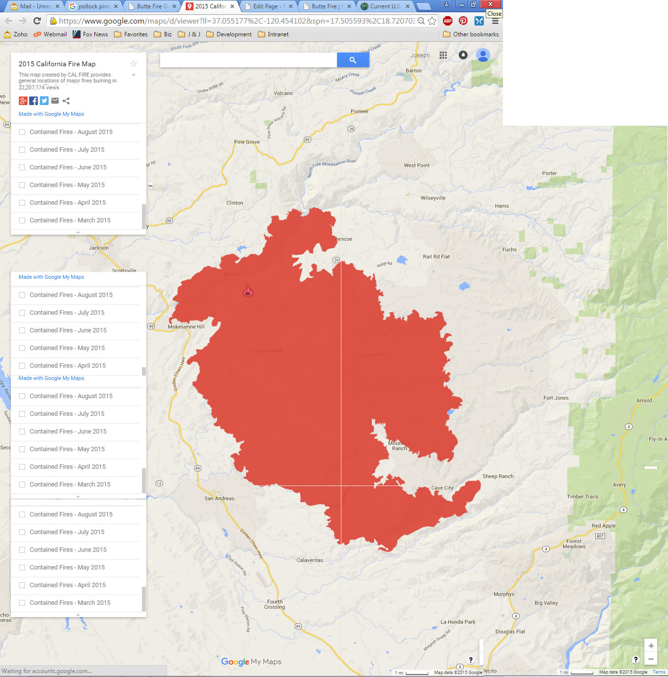
The following are “snapshots” of the Butte Fire over time from various sites. These snapshots are being provided to show the progress of the fire as a public service. All images are © Copyright by their respective publishers.
Refresh this page often for the latest information.
- September 10, 2015, 18:30
- September 11, 2015, 06:43
- September 11, 2015, 09:00
- September 11, 2015, 15:03
- September 11, 2015, 19:08
- September 12, 2015, 07:15
- September 12, 2015, 08:30
- September 14, 2015, 09:30
- September 15, 2015, 06:45
- September 15, 2015, 07:15
- September 15, 2015, 14:00
- September 16,2015, 07:00
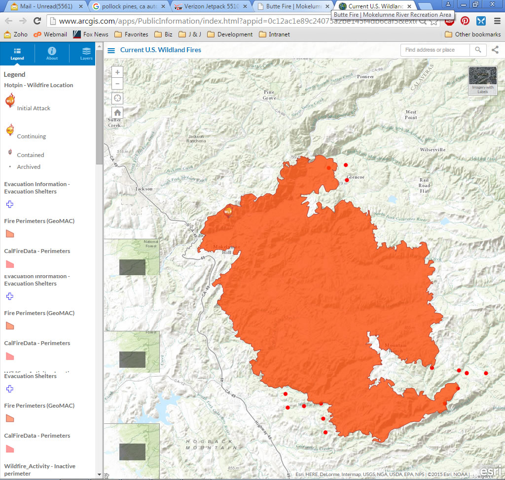
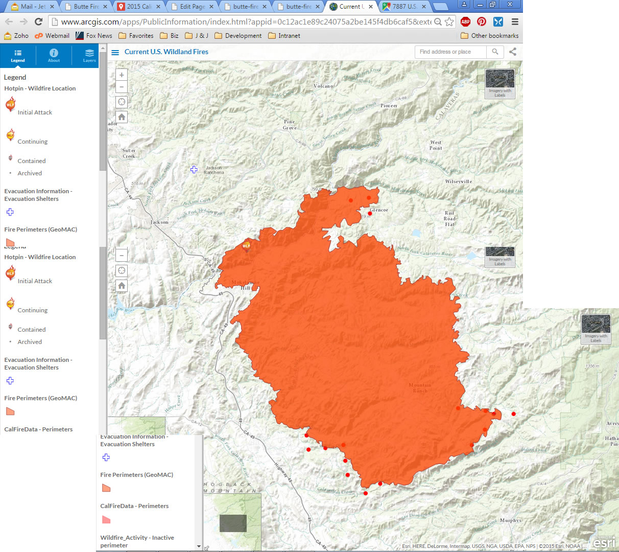
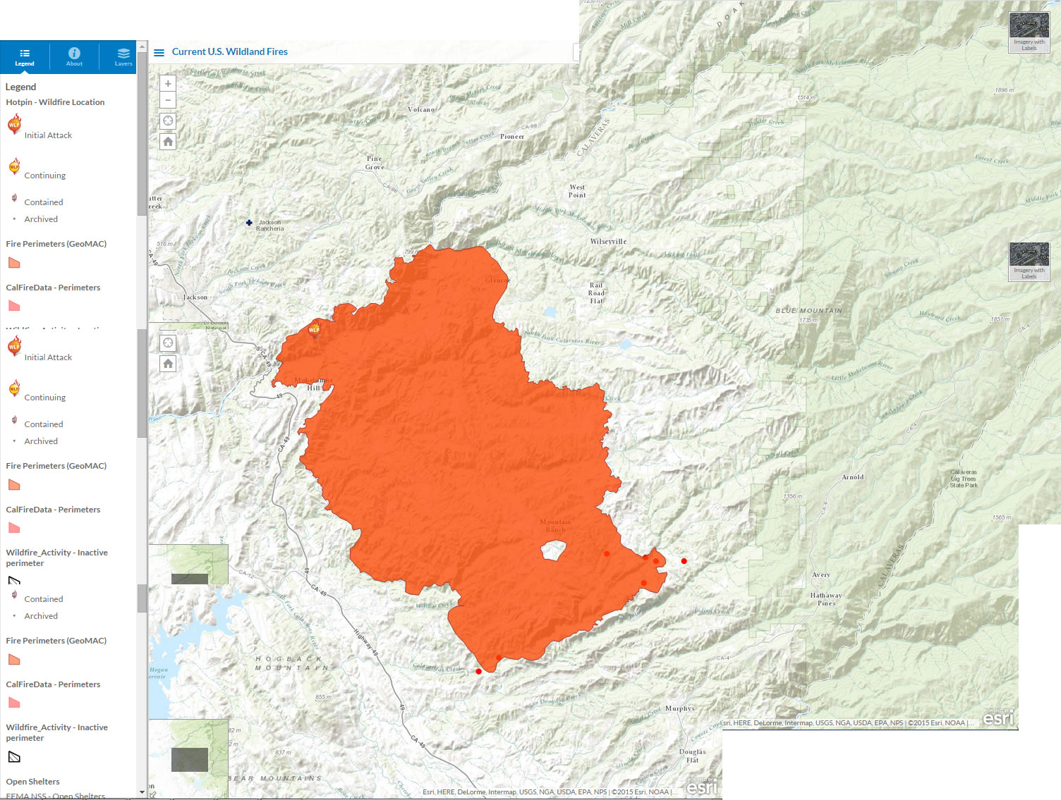
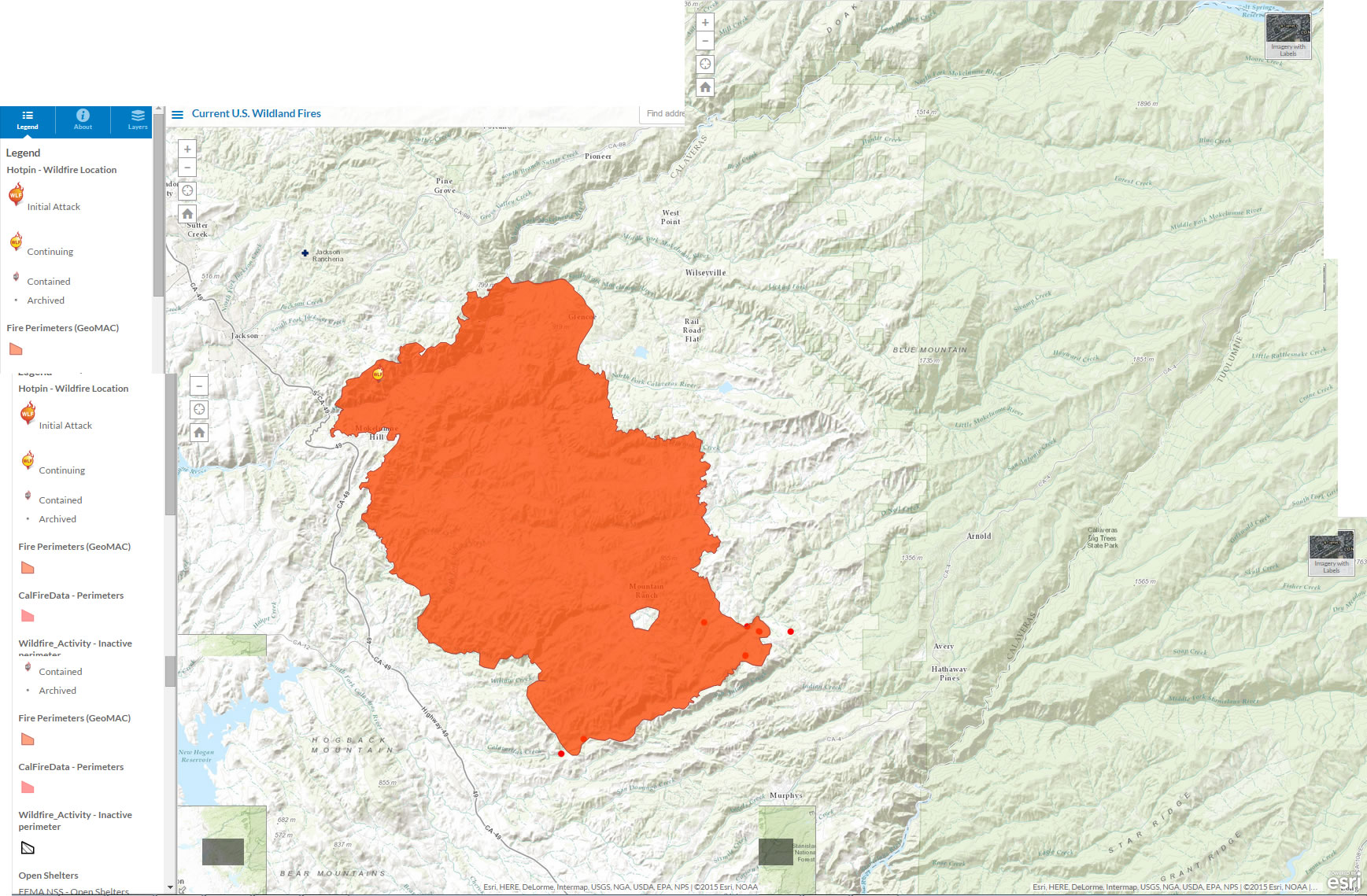
ArcGIS Map
Note: The red dots represent MODIS (MODerate Resolution Imaging Spectroradiometer) Thermal images taken from NASA’s three earth-orbiting satellites.
- September 11, 2015, 14:02
- September 11, 2015, 16:47
- September 11, 2015, 19:50
- September 12, 2015, 07:15
- September 12, 2015, 08:00 (stitched image)
- September 12, 2015, 15:00 (stitched image)
- September 14, 2015, 10:30 (stitched image)
- September 14, 2015, 14:41 (stitched image)
- September 15, 2015, 10:00 (stitched image)
- September 15,2015, 15:24 (stitched image)
- September 16, 2015, 07:00 (stitched image)
- September 11, 2015, 19:44
- September 12, 2015, 07:15
- September 12, 2015, 10:00 (stitched image)
- September 14, 2015, 11:37 (stitched image)